DSpace JSPUI
DSpace preserves and enables easy and open access to all types of digital content including text, images, moving images, mpegs and data sets
Learn MorePlease use this identifier to cite or link to this item:
http://hdl.handle.net/10786/877Full metadata record
| DC Field | Value | Language |
|---|---|---|
| dc.creator | Cooperación Latino Americana de Redes Avanzadas, (RedCLARA) | - |
| dc.rights.accessrights | openAccess | spa |
| dc.date.accessioned | 2014-10-10T12:22:24Z | - |
| dc.date.available | 2014-10-10T12:22:24Z | - |
| dc.date.created | 2011-03 | - |
| dc.date.issued | 2014-10-10 | - |
| dc.format.mimetype | spa | |
| dc.identifier.uri | http://hdl.handle.net/10786/877 | - |
| dc.language.iso | eng | spa |
| dc.subject | mapa | spa |
| dc.subject | topología | spa |
| dc.subject | conectividad | spa |
| dc.type | Map | spa |
| dc.title | Topología RedCLARA (mapa ilustrado), marzo 2011. Proyecto ALICE2 (América Latina Interconectada con Europa 2). | spa |
| Appears in Collections: | Mapas Topología RedCLARA | |
Files in This Item:
| File | Description | Size | Format | |
|---|---|---|---|---|
| 13-Topology_RedCLARA_illustratedMap_March_es_2011.pdf | 6,37 MB | Adobe PDF | 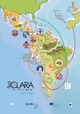 View/Open |
This item is licensed under a Creative Commons License
